Tag Archive for: metgis

The new MetGIS 2024 website is live!

Over the past few months, we have been working intensively on our new website to make it even easier for you to find the right product. We aimed to provide you with the simplest possible access to our weather parameters.
Since our product portfolio has grown significantly in recent years, a complete website overhaul was long overdue. We took this opportunity to present our offerings in a modern, clearly structured design.


A particular focus was on considering the diversity of our customers and their use cases for weather parameters. Whether for tourism, outdoor activities, agriculture, or other industries – our new website makes it easy to gather information beforehand. You can quickly see which products you need and either order them directly in the webshop or submit an inquiry.


But words alone can’t capture the difference – it’s best to check out the new site yourself and feel free to share your feedback with us!

From September 24th to 26th, we will be present at the MetTech World Expo in Vienna.

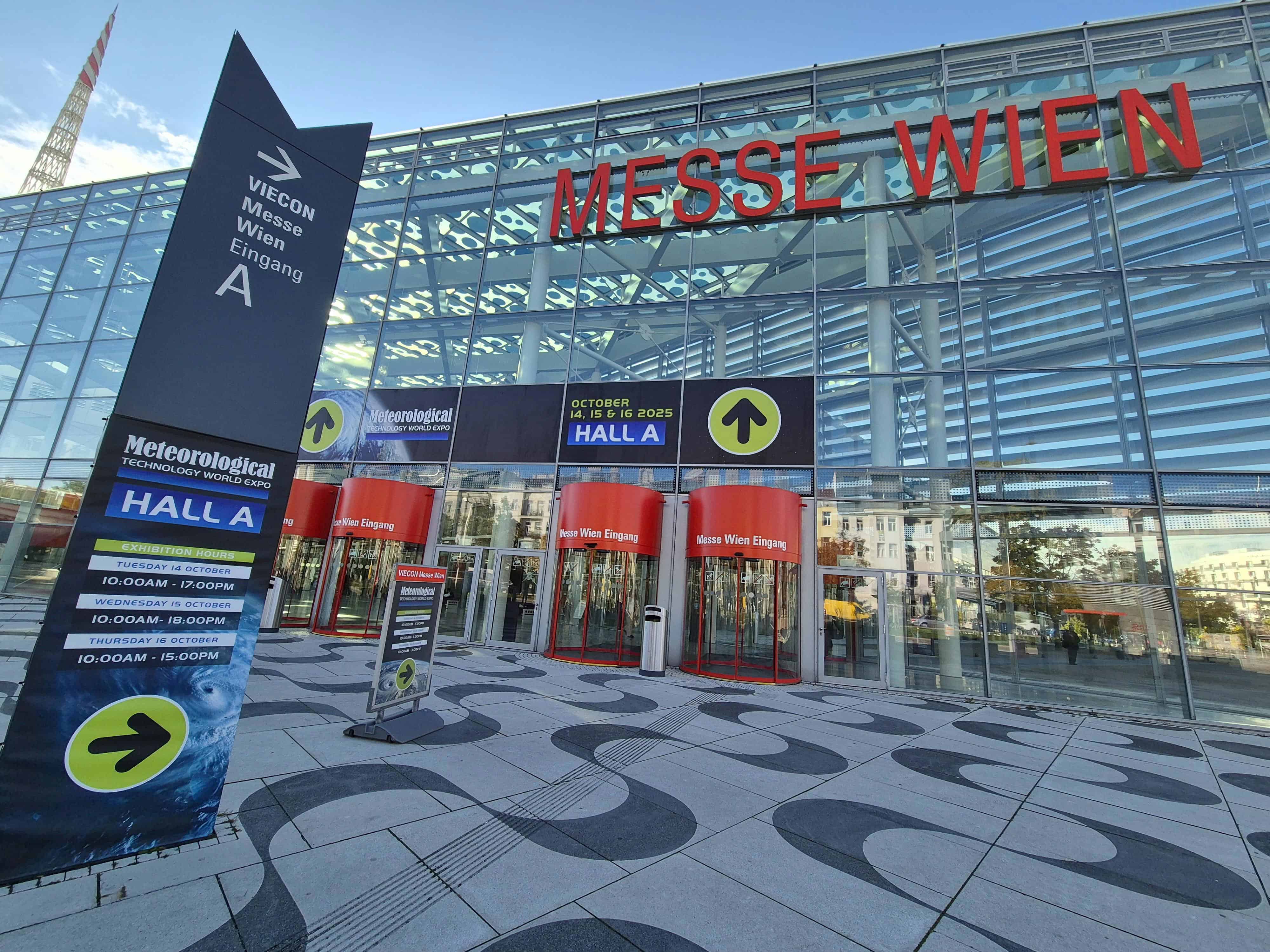
The Meteorological Technology World Expo is considered the world’s leading event for services and technologies in hydrometeorology and environmental monitoring. With more than 150 exhibitors and thousands of visitors from over 100 countries, it is the largest trade fair of its kind globally.

Our booth will be located in Messehalle Wien.

Hall A, Booth 1048

You can find information on how to reach us on Messehalle’s homepage. We recommend using public transportation.

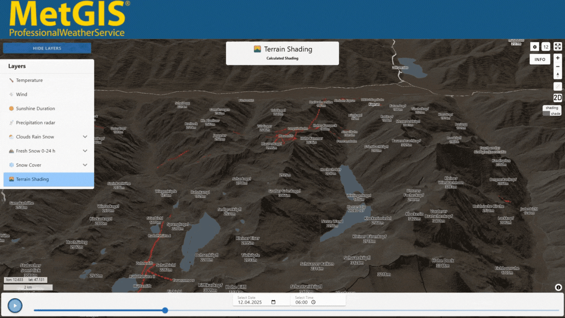
We will be showcasing our latest developments, including the following:

The New MetGIS Pro+ Dashboard

One highlight is the new MetGIS Pro+ Dashboard. This innovative, turnkey weather platform offers high-resolution, zoomable weather forecasts for specific regions. With forecast tables for up to 10 days, it is accessible 24/7. Through an intuitive user interface, users can view weather data without requiring technical expertise. The dashboard supports industries such as tourism, energy, and agriculture, delivering precise weather data available worldwide. The solution is also user-friendly and customizable to individual needs. You can find more details on our MetGIS Pro+ page.

Brand New Snow Depth and Fresh Snow Maps

Our new snow depth and fresh snow maps offer an impressive resolution of up to 30 meters. Using satellite data and proprietary weather models, they provide precise information on snow and weather conditions. These maps are available through the MetGIS Maps API, the Point API, and the MetGIS Pro+ Dashboard, supporting various sectors like tourism, winter activities, and environmental protection. Features such as fresh snow amount forecasts and specialized weather parameters provide a comprehensive solution for winter planning. More details can be found on our Snow and Winter page.

Visit us at the MetTech World Expo and learn more about these and other exciting developments.

Dr. Gerald Spreitzhofer

Geschäftsführer

Meteorologe, Entwickler des Designs des MetGIS Prognosesystems
Curriculum vitae

This will close in 0 seconds

Mag. Stefan Sperka

Technischer Director

Meteorologe, IT-Experte
Curriculum vitae

This will close in 0 seconds